Hydraulic Study and Flood Risk Assessment for A&H Mixed Land Use Development Responsive Axiom project page using user-supplied project images. HYDRAULIC STUDY AND FLOOD RISK ASSESSMENT FOR A&H MIXED LAND USE DEVELOPMENT Flood Risk Assessment, Hydraulic Modelling, Stormwater Drainage Strategy CLIENT: Ansar Group COUNTRY / YEAR: Oman / 2026 PROJECT TYPE: Hydraulic Study & Flood Risk Assessment AXIOM ROLE: Hydrology, hydraulics and flood risk engineering Axiom was commissioned to undertake a comprehensive Hydraulic Study and Flood Risk Assessment for the proposed A&H Mixed Land Use Development. The objective of the study was to evaluate existing hydrological conditions, identify potential flood hazards, and develop practical engineering recommendations to ensure that the proposed development can be implemented safely and sustainably. The study included catchment delineation, rainfall-runoff analysis, hydraulic assessment of surrounding wadis and drainage systems, evaluation of flood extents under various storm events, and preparation of mitigation measures where required. The assessment was carried out in accordance with relevant authority requirements and international engineering practice to support planning approvals and future infrastructure design. KEY SCOPE Hydrological catchment assessment Rainfall-runoff modelling Hydraulic analysis of drainage and wadis Flood hazard and flood extent mapping Flood mitigation strategy Drainage design recommendations Authority submission support and technical reporting AXIOM ENGINEERING EXCELLENCE

Hydraulic Study and Flood Risk Assessment for A&H Mixed Land Use Development

Flood risk assessment, hydraulic modelling, drainage strategy, and development resilience

Axiom was commissioned to undertake a comprehensive Hydraulic Study and Flood Risk Assessment for the proposed A&H Mixed Land Use Development. The objective of the study was to evaluate existing hydrological conditions, identify potential flood hazards, and develop practical engineering recommendations to ensure that the proposed development can be implemented safely and sustainably.

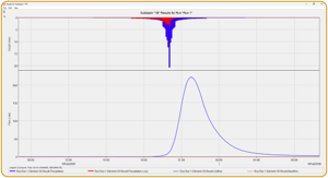
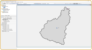
The study included catchment delineation, rainfall-runoff analysis, hydraulic assessment of surrounding wadis and drainage systems, evaluation of flood extents under various storm events, and preparation of mitigation measures where required. The assessment was carried out in accordance with relevant authority requirements and international engineering practice to support planning approvals and future infrastructure design.
Hydraulic Study and Flood Risk Assessment for A&H Mixed Land Use Development visual 1 Hydraulic Study and Flood Risk Assessment for A&H Mixed Land Use Development visual 2 Hydraulic Study and Flood Risk Assessment for A&H Mixed Land Use Development visual 3 Hydraulic Study and Flood Risk Assessment for A&H Mixed Land Use Development visual 4 Hydraulic Study and Flood Risk Assessment for A&H Mixed Land Use Development visual 5 Hydraulic Study and Flood Risk Assessment for A&H Mixed Land Use Development visual 6
KEY SCOPE
  • Hydrological catchment assessment
  • Rainfall-runoff modelling
  • Hydraulic analysis of drainage and wadis
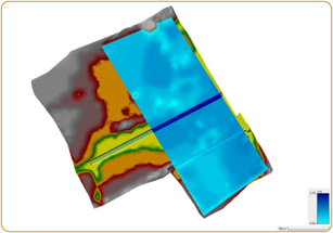
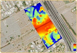
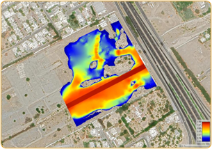
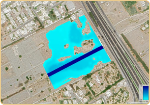
  • Flood hazard and flood extent mapping
  • Flood mitigation strategy
  • Drainage design recommendations
  • Authority submission support and technical reporting